Monday, June 26, 2006
Borders
Border Films
The Borders Trilogy / Invisible America / Alex Rivera
PART 1: Love on the Line > Families divided by the U.S./Mexico border reunite for transnational picnics.
PART 2: Container City > Newark, New Jersey, a different kind of bordertown. Here, the border crossers are fifty feet long and they actually are taking over.
PART 3: A Visible Border > Twenty-first century immigrants respond to a world in which borders are closed for people, but open for products.
The Other Side / Bill Brown
The desert that marks the border between the U.S. and Mexico is the subject of Bill Brown’s deeply personal reflection on and exposé of the challenges surrounding Mexican immigration. Pensive, raw, and luminous images construct a montage of a land where immigrants leave traces of their struggles and hopes. Traveling along these same paths, Brown shows us “where the idea of America is up for grabs” and explores the vicissitudes of the politics and activism behind U.S. immigration policies. We ride in the cars of activists protecting the rights of migrants, set up water stations, listen to the tales of crossing attempts, learn the history of the land, and watch the shadows creep across the fixtures of life isolated in the desert.
Performing the Border / Ursula Biemann
Performing the Border is a video essay set in the Mexican-US border town Ciudad Juarez, where the U.S. industries assemble their electronic and digital equipment, located right across from El Paso, Texas. Performing the Border looks at the border as both a discursive and a material space constituted through the performance and management of gender relations. The video discusses the sexualization of the border region through labor division, prostitution, the expression of female desires in the entertainment industry, and sexual violence in the public sphere. Interviews, scripted voice over, quoted text on the screen, scenes and sounds recorded on site, as well as found footage are combined to give an insight into the gendered conditions inscribed in the border region.
Border / Laura Waddington
In 2002, Laura Waddington spent months in the fields around Sangatte Red Cross camp, France with Afghan and Iraqi refugees, who were trying to cross the channel tunnel to England. Filmed at night with a small video camera, the figures lit only by the distant car headlights on the motorways, Border is a personal account of the refugees' plight and the police violence that followed the camp's closure.
Border Activism
no border network
The no border network is a tool for all groups and grass root organizations who work on the questions of migrants and asylum seekers in order to struggle alongside with them for freedom of movement, for the freedom for all to stay in the place which they have chosen, against repression and and the many controls which multiply the borders everywhere in all countries. This network is different from lobbying groups and NGOs because it is based on groups of grass root activists and intends to stay so.
deleteTheBorder.org
Deletetheborder.org is an online community with the goal of nurturing a global network of movements against borders. We began the project in 2005. Sensing the tremendous potential energy and having seen the existence of many networks around the world like NoBorder.org and No One Is Illegal in Canada, we sought to use the latest technology to provide a site which would make international connections and act as a hub of resistance and emergence...
Border Events
STRANGE NEW WORLD | Art and Design from Tijuana
MCASD Downtown / May 21 - September 17, 2006
MCASD La Jolla / May 21 - September 3, 2006
Tijuana is a new cultural hot spot. Influential publications in the United States, Europe, and Mexico have recognized the city as a vibrant site of innovation in the arts. Journalists, scholars, and critics alike celebrate Tijuana's diversity of artistic production from art made with traditional media, such as, painting and printmaking to installation and conceptual art; from photography to digitally derived images; from street-level video to ambitious feature films; from utopian architectural proposals to streamlined and economic housing design. As the city's newest art weekly recently announced, "Tijuana moves - and it's everywhere."
This exhibition will document the recent explosion of artistic experimentation in Tijuana, and will also explore the subtle shift in focus from art about the border experience to art that takes advantage of a new type of accelerated urbanism being pioneered in developing cities around the world.
The Political Equator
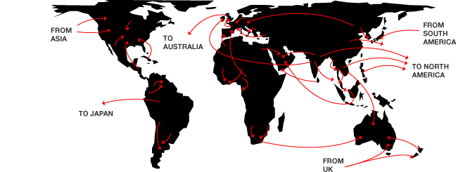
Tracing an imaginary line along the US/México border and extending it directly across a map of the world, what emerges is a political equator that roughly corresponds with the revised geography of the post-9/11 world according to Thomas P. M. Barnett’s scheme for The Pentagon’s New Map, in which he effectively divides the globe into “Functioning Core,” or parts of the world where “globalization is thick with network connectivity, financial transactions, liberal media flows, and collective security,” and “Non-Integrating Gap,” “regions plagued by politically repressive regimes, widespread poverty and disease, routine mass murder, and ... chronic conflicts that incubate the next generation of global terrorists.”
inSite_05 - San Diego Tijuana
inSite is dedicated to the realization of binational collaborative arts partnerships among nonprofit and public institutions in the San Diego-Tijuana region. Operating through a unique collaborative structure that is based on the active participation of cultural and educational institutions in the US and Mexico, inSite is focused on promoting artistic investigation and activation of urban space.
The distinctive character of inSite, understood as a cultural practice of intervention in the urban social weave, stems from a commitment to facilitate new works developed through a long-term engagement with the artists. The core of inSite, as it has evolved over the past twelve years, is commissioning projects as interventions in the extraordinary context of the San Diego-Tijuana border region. The axis of this project is a process of two-year periodic residencies that culminate in the realization of works sited in the public domain throughout the two cities. The flexibility to respond to the shifting interests of artists and institutions and, in turn, to test new structures of collaboration and venues for the presentation of innovative work, has been a fundamental characteristic of this project.
Border Crossings @ Tate Modern
Europe's borders are increasingly frontlines of political and social dissent. Asylum-seeking and political migration are some of the most significant issues of our time. This discussion will explore the contentious role of borders in Europe and beyond, and the way artists are contesting these geographical and cultural perimeters.
At this evening seminar, artist Heath Bunting talked about his project, BorderXing Guide, which consists of 'walks' that traverse national boundaries without interruption from customs, immigration, or border police. The project is on display on Tate's website. German critic and activist, Florian Schneider discussed the disruption of European borders through civil disobedience campaigns. Writer and critic Armin Medosch chaired the discussion.
Border Projects
alien
alien is a project by Heidrun Holzfeind about migration and borders. It integrates text and image based art work, general information about the issue and links to other websites.
Tijuana Calling / inSite_05
Tijuana Calling is an online exhibition of five commissioned projects that make use of the Internet to explore various features of the Tijuana/San Diego border region, including cultural tourism, border dentistry, transborder narco-tunnels, vigilante surveillance drones, and the journalistic hype surrounding border crime. Like the inSite_05 Interventions, these projects grew out of a lengthy process of research and investigation. Although all five projects exist online, they adopt a wide range of artistic strategies, from gameplay to tactical literature. As part the inSite_05 web site, Tijuana Calling describes and links to these projects, but the projects themselves exist elsewhere on the Internet.
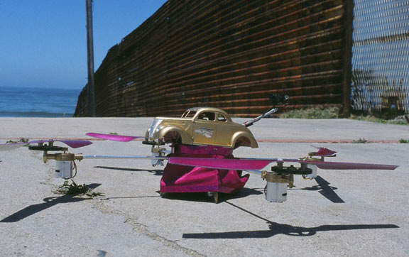
Low Drone - The Transnational Hopper
2005 — The LowDrone, the world’s first aerial lowrider armed with video surveillance capabilities, is invented. The LowDrone is currently stationed at one of the most surveilled spaces on the planet – the U.S./Mexico border between Tijuana and southern California.
Dentimundo
Dentimundo.com is a multimedia documentary of this micro-economy between the U.S. and Mexico that investigates border dentistry while also presenting users with a directory of dentist clinics along the border.
Cutting, Climbing, Crossing / Heath Bunting @ OVERGADEN
Institute of Contemporary Art
”Cutting, Climbing, Crossing” will present a number of Heath Bunting’s recent works which deal with issues of borders, identity and physical space. Central to the exhibition will be the world premiere of Bunting’s ongoing project “The Status Project”, a mapping of the multi-layered logic of the mobility and legal routes of the social system. The work will be presented as wall-mounted diagrams, an interactive database and a 4,200-page manual!
We are all Boat People
The 'We are all Boat People' campaign is concerned in the broadest sense with the mental health of Australia. In our analysis, what we are facing is not so much a refugee problem as a crisis of xenophobia, a terrible and contagious national sickness. The border panic policies of our government are clearly designed to spread fear and hatred, disseminated through brilliant manipulation of the unspeakable psychoses of an occupying nation secretly uncertain of its own legitimacy.
Transit Migration / MigMap - Governing Migration
Transit Migration is a transdisciplinary research, film, sound and exhibition project that builds on the collaborative efforts of academics, film makers, media activists and artists.
It examines the ways in which transnational migration movements are transforming Europe and asks how, and whether, it is possible to represent this reality in academic discourse, in the media and in art. The participants in the project develop and employ a wide variety of research methods, all of which are designed to work in a synergistic fashion.
MigMap – Governing Migration
A Virtual Cartography of European Migration Policies
MigMap conveys a picture of how and where the production of knowledge is currently taking place in the area of migration – and of who is participating in and has access to it. MigMap investigates precisely how the new forms of supranational governance that can be observed in the European migration regime function. It looks, for example, at how European standards in politics and civil society are implemented, and at the authorities, persons and institutions taking part in this process. It examines how the various key players in the public and private spheres are interrelated and funded, as well as at the ways in which these spheres overlap or differ in terms of focus, location or personnel. Finally, it analyses how responsibilities are allocated and legitimised – and explores the theories, data and discourses upon which current paradigms in migration are based.
Border Essays
Desert Crossroads (Rising Resistance to Corporate Globalisation and Deadly Borders) / by o.r.g.a.n.i.c
As xenophobic border regimes around the world rigidify, activist groups are joining forces to denounce them and the neoliberal economics on which they stand. Amidst a worsening climate of vigilantism, San Diego based anarchist collective o.r.g.a.n.i.c. report on recent antiborder actions in the towns, desert wastelands and graveyards along the US/Mexico border
Real Politik versus Real Fantasy (Review of the Tate Modern's Border Crossing seminar) / by Benedict Seymour
At the Tate Modern's Border Crossing seminar, the artist/activist approaches of panelists Heath Bunting and Florian Schneider threw divergent light on the politics of migration.
Knocking Holes in Fortress Europe / by Florian Schneider
Just as resistance needs to be as global as capital, hacking the borders of Europe – physically and politically – needs to be as networked as the surveillance regimes that protect them. Florian Schneider, a veteran anti-borders activist himself, gives an overview of the multiple campaigns now underway across Europe....
BORDERPANIC Reader / by Linda Carroli
BORDERPANIC: interview with Deborah Kelly and Zina Kaye / by Tracey Benson
subsol / borders
borderlands e-journal / Borderphobias: the politics of insecurity post-9/11
Sunday, June 25, 2006
The Public Domain?
This is the Public Domain
This is the Public Domain is a project to create a permanent international commons. The land will be free to anyone to use, and will be held in perpetuity. In 2003, a 2.5 acre parcel was purchased to serve as the site for the proposed public domain. Located in Tehachapi, California, sharing of this commons will be initiated when a juridical solution for public handover is found....
This is the Public Domain / by Hari Kunzru
Hari Kunzru on Amy Balkin's guerilla-conceptual artwork that exposes the near impossibility of creating public space in the US
In recent years, artistic and political engagements with the concept of the commons have tended to focus on the new possibilities emerging online. Digital media is forcing change in IP regimes. Models based on shared, free or open virtualities are proposed to salvage public space at a time when it is physically under threat. As the marketplace becomes a mall and the village green a branded leisure-space the customary rights of free speech and association traditionally attached to such places are also eroded. Amy Balkin, living in California, has opted to look again at real space. Her project This is the Public Domain has a simple aim: ‘to create a public commons that will exist in perpetuity.’ ‘This land,’ she writes, ‘will be permanently available, free, for use by anyone. Citizenship is not necessary to participate.’ In a move which flies in the face of a social and legal system designed specifically to enforce land ownership, she has bought 2.5 acres of land near the Mojave desert and is instituting moves to transfer it out of her name into that of – nobody. Everybody. All of us....
Amy Balkin / This Is the Public Domain / Bulletin Board Project / CCA Wattis Institute for Contemporary Art
Amy Balkin's art practice combines cross-disciplinary research and social critique with a search for unrealized possibilities outside current formal systems. Her ongoing project This Is the Public Domain is an effort to create a permanent international commons from 2.5 acres of land she has purchased near Tehachapi, California, via legal transfer of ownership to the global public.
Balkin finds historical precedents in the Commons of pre-17th century England and the LATWIDN (Land, Access To Which Is Denied No-one) experiment at Lou Gottlieb's Morning Star Ranch in Sonoma, California, in the 1970s. More recent parallels can be seen in the free/open source software movement and the copyleft and Libre Commons Res Communes licenses for intellectual property.
For the Wattis Institute Bulletin Board, Balkin has produced a series of posters in the tradition of 19th-century broadsides. With their combination of proclamation and information, these posters both promote the Open Land philosophy and present some of the problems and questions encountered in the search for a working real-world framework.
Public Smog
Public Smog is a public park composed of intangibles and built in the economic realm of carbon offset trading. Offsets purchased and controlled by the public will be inaccessible to polluting industries. The park will exist as a construct of heightened air quality occuring in the unfixed public space. The park's size will vary, reflecting shifting financial control of carbon offset shares, compounded by naturally occuring seasonal fluctuations in air quality....
COMMONspace / rebar
Spring 2006 - Spring 2007
COMMONspace is a project to explore and evaluate San Francisco's privately-owned public spaces.
In an effort to provide more public space downtown, the City of San Francisco has partnered with private developers to create a number of privately-owned public spaces. Some of these spaces are open and inviting - activated by public use. Others are under heavy surveillance, difficult to find, appear private, or are fundamentally inaccessible. To date, these spaces have not been systematically evaluated.
The goal of COMMONspace is to evaluate, activate and reclaim these spaces as a critical part of the public realm and as a valuable component of San Francisco's intellectual and artistic commons. We aim to determine just how public are these privately-owned public spaces?
PARK(ing): a temporary urban park / rebar
Providing temporary public open space in a privatized part of town.
One of the more critical issues facing outdoor urban human habitat is the increasing paucity of space for humans to rest, relax, or just do nothing.
For example, more than 70% of San Francisco's downtown outdoor space is dedicated to the private vehicle, while only a fraction of that space is allocated to the public realm.
Feeding the meter of a parking space enables one to rent precious downtown real estate, typically on a 1/2 hour to 2 hour basis. What is the range of possible occupancy activities for this short-term lease?
Aerial photograph of Cabinetlandia (the blue box) and vicinity. Your magazine-sized plot in Readerland is accessible on the north from the Union Pacific Railroad, and on the south from Interstate Highway 10.
Cabinetlandia
Cabinet Magazine / Issue 10 / Spring 2003
Land Acquisition 1: Luna County, New Mexico
This project has been co-organized by Jeffrey Kastner, Sina Najafi, Paul Ramirez Jonas, Jay Worthington, and Brian McMullen.
There is an old Chinese story that says each person is connected by an invisible thread to the one other person in the world who is right for them, the person with whom they will eventually fall in love. In this tale, fate has already ordained the union of the pair; the couple need only find the thread to discover their predestined connection. For the Property issue, Cabinet decided to trace the sympathetic threads not between two individuals but between several disparate pieces of land: a half-acre parcel of desert scrubland in Luna County, New Mexico; 13 unusably small and bizarrely shaped lots in the New York City borough of Queens, originally purchased by the artist Gordon Matta-Clark for his 1973 work Reality Properties: Fake Estates; and 3.125 selims (2000 acres) of land in Eastern Amazonis Planitia on the planet Mars.
Building the Cabinet National Library
In July 2003, we received a letter from someone in San Francisco purporting to be a devoted reader of Cabinet, one Matthew Passmore. His outlandish and extravagant scheme for building the Cabinet National Library on one of the project spaces seemed to be the stuff of a Werner Herzog short. We published his letter and diagrams in issue 12. To our astonishment, this past summer he made good on his perhaps hasty promise to go out to New Mexico with some friends and build the library. Here is his report.
Cabinet National Library / rebar
Upon reading the Cabinetlandia article, something immediately obvious occurred to us: Cabinetlandia would require a Cabinet National Library (i.e., a library containing all and only back issues of Cabinet magazine). What better way to establish your civilization than to create a repository for its organizing documents?
Manual for LAND / N55
Introduction:
LAND gives access to land. Any person can stay in LAND and use it.
Construction:
LAND is constructed from pieces of land in different places in the world. The various parts are added to LAND by persons who guarantee that anybody can stay in LAND and use it. Any person can initiate expansions of LAND. The geographical positions of LAND can be found in Manual for LAND. The manual is continuously updated at www.N55.dk/LAND.html. A current version can also be obtained by contacting N55.
Using LAND:
Any person can use LAND. Attention is directed to the logical relation between persons and the rights of persons. Persons should be treated as persons and therefore as having rights. If we deny this assertion it goes wrong: here is a person, but this person should not be treated as a person, or: here is a person, who should be treated as a person, but not as having rights. Therefore we can only talk about persons in a way that makes sense if we know that persons have rights.
Expanding LAND:
LAND can be expanded by anybody who wants to add pieces of land to LAND. Formally, the parts of LAND remain the property of the persons participating in this way, but they guarantee that any person can stay in LAND and use it. By informing N55 of the position, a cairn will be put out to mark the place and the position will be distributed through the manual.
AVL-Ville
AVL-Ville is the biggest work of art by Atelier van Lieshout to date. This free state is an agreeable mix of art environment and sanctuary, full of well-known and new works by AVL, with the special attraction that everything is fully operational. Not art to simply look at, but to live with, to live in and to live by.
The Principality of Sealand
Sealand was founded as a sovereign Principality in 1967 in international waters, six miles off the eastern shores of Britain. The island fortress is conveniently situated from 65 to 100 miles from the coasts of France, Belgium, Holland and Germany. The official language of Sealand is English and the Sealand Dollar has a fixed exchange rate of one U.S. dollar. Passports and stamps have been in circulation since 1969, however, contrary to many misleading websites and news articles, Sealand passports are not for sale, and anyone offering such are selling forgeries. Within a radius of 500 miles of Sealand live more than 200 million people who enjoy some of the highest standards of living in the world. This area also encompasses the financial, industrial and cultural heart of Europe.
The Paradox of the 10 Acres Square / eteam
Through a successful ebay bid in January of 2004, 1975 eteam Dollars turned into 10 Acres of personal US property. The lot, a generic square within the larger American grid of townships, is located in the desert of Nevada. The closest settlement, Montello, “The town that refuses to die”, is 8 miles away and the almost abandoned airbase Wendover, at the edge of the Salt Flats, is located about 30 miles SE. It’s this 10 Acre lot and it’s surroundings that started the eteam’s search for solutions to problems, which were created by big systems that had made some small mistakes. They dealt with miscalculations of land surveyors, residues of the military, the appearance of dead cows and the existence of a “public road” , that went right through the center of their lot. In the middle of nowhere, things added up and finally turned into an “Artificial Traffic Jam”.
Toronto Public Space Committee
The Toronto Public Space Committee is a grassroots non-profit organisation run completely by volunteers.
Founded in 2001, we have quickly become one of the loudest voices representing Toronto's streets, sidewalks, parks and alleyways.
We are dedicated to protecting our shared common spaces from commercial influence and privatisation. While some see the streets as an untapped source of advertising revenue we see protected public spaces as a fundamental pillar of a healthy democracy. If only wealthy advertisers have access to our visual environment, then freedom of speech suffers in our city.
We are citizens first, and consumers second. Public space must reflect this distinction, and should be fully and equally accessible by all who walk through it. Public space is the guarantee of a space for citizens to engage in society and interact with each other without commercial influence.
Through our advocacy projects we affect municipal policy, help shape the debate and create a space for concerned citizens to get involved and participate. Through our community events we lead by example by beautifying the city without a big budget, without sponsors and without logos. Together, we are reclaiming our streets and creating community.
We invite you to join us!
Two books....
The Right to the City: Social Justice and the Fight for Public Space / Don Mitchell
The Politics of Public Space / Setha Low & Neil Smith
Monday, June 05, 2006
CLUI & Friends
About The Center
Dedicated to the increase and diffusion of information about how the nation's lands are apportioned, utilized, and perceived.
The Center for Land Use Interpretation is a research organization interested in understanding the nature and extent of human interaction with the earth's surface. The Center embraces a multidisciplinary approach to fulfilling the stated mission, employing conventional research and information processing methodology as well as nontraditional interpretive tools.
The organization was founded in 1994, and since that time it has produced over 30 exhibits on land use themes and regions, for public institutions all over the United States, as well as overseas. Public tours have been conducted in several states, and over ten books have been published by the CLUI. CLUI Archive photographs illustrate journals, popular magazines, and books by other publishers, and have been used in non-CLUI exhibitions, and acquired by art collectors.
The CLUI exists to stimulate discussion, thought, and general interest in the contemporary landscape. Neither an environmental group nor an industry affiliated organization, the work of the Center integrates the many approaches to land use - the many perspectives of the landscape - into a single vision that illustrates the common ground in "land use" debates. At the very least, the Center attempts to emphasize the multiplicity of points of view regarding the utilization of terrestrial and geographic resources.
TOURS / EXHIBITS / PUBLICATIONS
The Lay of The Land NEWSLETTER
Land Use DATABASE / SUGGEST A SITE
The Center for Land Use Interpretation's Land Use Database is an on-line computer database of unusual and exemplary sites throughout the United States. It is a free public resource, designed to educate and inform the public about the function and form of the National landscape, a terrestrial system that has been altered to accommodate the complex demands of our society.
Wendover Residence Program
The Center has established a residence program at The Center's Wendover Complex, located in the desert town of Wendover, Utah. The program enables participants to live in Wendover and produce work related to the unique and inspiring geographic region, which includes the Great Salt Lake and its desert and salt-flat environs. During the course of the residency, participants are asked to produce work that explores themes related to the area, work which will then be exhibited.
Touring the archive, archiving the tour: image, text, and experience with the Center for Land Use Interpretation / by Sarah Kanouse
Art Journal / Summer, 2005
Whether the visitor steps in from the blazing sunshine of a Culver City sidewalk, thumbs open the cardstock cover of a slim booklet, takes a reclining seat on an air-conditioned bus, or types a few letters in a browser, her point of entry to the work of the Center for Land Use Interpretation (CLUI) leads to an experience that defies the tidy categorizations of research, art, education, or tourism. An image greets her - an unremarkable image, an unromantic image, an image of land working, abandoned, or waiting to be put to work again. If she finds the image beautiful, the tourist gives way to researcher to find beauty in data: reconnaissance-style photos, soil, utility and irrigation maps, and snapshots of infrastructure. As she flips from page to page of her tour book or the online archive, shifts her focus from one image to another in the gallery, or gazes from the window at the changing landscape, the researcher again becomes a tourist, absorbing a carefully prepared text that dutifully explains what is being gazed upon in a way reminiscent of both tour guides and, paradoxically, the stalest of research and educational materials....
NOWHERE Class in Wendover w/CLUI
During the week-long guided project with Matthew Coolidge of the Center For Land Use Interpretation (CLUI), the Curatorial Practice class looked at various sites (thinking of place and space as a "curatable" medium), to examine how curating is the construction of a point of view, and can be a creative process that makes something out of "nothing."
Matthew Coolidge is the Founder and Director of the Center for Land Use Interpretation (CLUI) in Los Angeles, a non-profit art/research organization that employs a multimedia and multidisciplinary approach to increase and diffuse knowledge about how the nation’s lands are apportioned, utilized and perceived. He serves as a project director, photographer and curator for CLUI exhibitions, and has written several books published by the CLUI, including Back to the Bay: An Examination of the Shoreline of the San Francisco Bay Region (2001), and The Nevada Test Site: A Guide to America’s Nuclear Proving Ground (1996). He lectures widely in the United States and Europe on contemporary landscape matters, and is a faculty member in the Curatorial Practice Program at the California College of the Arts, where he teaches a class about “nowhere”. Coolidge received a John Simon Guggenheim Memorial Fellowship in 2004. (MA)
Steve Rowell
Playas, New Mexico: A Modern Ghost-town Braces for the Future
Steve Rowell of the CLUI has been documenting the town of Playas, and in particular the 230 homes slated for counter-terrorism training, creating a static, photographic index of this place that will, for the indefinite future, serve its role as a generic American suburb under simulated attack. A forthcoming exhibit is being planned using these and other materials. In March 2005, Rowell was involved in a residency program at the School of Architecture at Texas A&M in College Station, TX. There he worked with students to develop an exhibit on Playas, featuring photographs, video, an interactive map of the entire town, and an immersive virtual reality landscape using game and modeling software.
Sarah Simons
The Radon Baths: Old Montana Mine Shafts Furnished as Radioactive Health Spas
More CLUI Bus Tours Into the Desert: This Time it Was North, Out to Barstow and Beyond
Diversions & Dislocations: California's Owens Valley
Loop Feedback Loop: The Big Picture of Traffic Control In Los Angeles
Erik Knutzen
First CLUI Touchscreen Kiosk Deployed
A Visit to the Rainbow Gathering
Dutch Crater on Hold
& FRIENDS....
Jane Wolff / Delta Primer: A Field Guide to the California Delta
Jane Wolff began her career as a landscape and urban designer in the San Francisco Bay Area, where her project experience ranged from private gardens to urban design guidelines for the Main Post of the Presidio of San Francisco. Before her appointment at Washington University, she taught at the California College of Arts and Crafts and at Ohio State University's Knowlton School of Architecture. She is the author of Delta Primer, a book designed to educate diverse audiences about the contested landscape of the California Delta.
Her research deals with the hybrid landscapes produced by natural process and cultural intervention. Her study topics have included the architecture of the Finnish railway system, the history of land reclamation in the Netherlands, and the reconstructed landscapes of the Tennessee Valley Authority. Her work has been supported by two Fulbright Scholarships, a Charles Eliot Traveling Fellowship, and grants from the Graham Foundation for Advanced Study in the Visual Arts, the LEF Foundation, and the Great Valley Center.
Jane wolff Delves Into The Delta
Kazys Varnelis
Kazys Varnelis is a visiting scholar at the University of Southern California's Annenberg Center for Communication's "Networked Publics" program.
Kazys teaches the History and Theory of Architecture and Urbanism at the School of Architecture at the University of Limerick, Ireland. He is a founding principal of the non-profit architectural collective AUDC and occasionally works with the Center for Land Use Interpretation.
Kazys's teaching and research explores contemporary architecture, late modernism, architecture and capitalism, and the impact of recent changes in telecommunications and demographics on the contemporary city.
AUDC / Architecture - Urbanism - Design - Collaborative
AUDC uses the tools of architecture to research the role of the individual and the community in the contemporary urban environment. AUDC constructs realities not objects. Underscoring our work is a belief in finding ways of bringing people together. We define our practice by adhering to a system of core values that instill all our work with integrity and meaning.
Love: Envisioning communities – even if dispersed - based on caring, sharing, and belonging.
Beauty: To set an example for people to rise to.
Ethics: To instill, by demonstration, a way of acting, to demonstrate integrity.
Abstraction: To create a background that allows individuals to define identities amidst the infinite possibilities of contemporary life.
Tandem Surfing the Third Wave: AUDC & The Disappearance of Architecture / Ryan Griffis interviews AUDC
Julia Christensen / Big Box Reuse
Julia Christensen is an artist from Kentucky. Her work treads on the thin line between art and research. She also likes to tread on most of the thin lines between various media, between the electronic and the non-electronic, and between audience and performer.
Julia has taught and lectured across academic fields, in departments of art and art history, electronic/digital media, architecture, law, and information technology. Currently she is a lecturer at Stanford University in the Experimental Media Arts division, and a member of the Core facutly at the California College of the Arts. Julia received her BA in Integrated Art from Bard College, in Annandale-on-Hudson, NY. She received her MFA in Electronic Music and Recording Media at the Center for Contemporary Music at Mills College, in Oakland, CA. She received her MFA in Electronic Arts at the iEAR Studios at Rensselaer Polytechnic Institute in Troy, NY.
Julia is currently investigating the rebuilding efforts that are taking place in the U.S. Gulf Coast region after the tragic hurricanes of 2005. Her land use explorations began with the project How Communities are Reusing the Big Box, an on-going project that began in January of 2004. This research has manifested itself through digital photography, digital video and audio, along with live presentations that Julia is giving throughout the country. She developed a project web site, www.bigboxreuse.com, that provides a hub to communities throughout the world that are involved in individual reuse endeavors, as well as creating an accessible database of various reuse sites. Julia lectures extensively, and has worked with the Center for Land Use Interpretation since the beginning of the research.
Los Angeles Forum for Architecture and Urban Design
Founded in 1987, the Los Angeles Forum for Architecture and Urban Design is a non-profit organization dedicated to supporting innovative art, architecture, design, and urbanism that takes this city as a laboratory. The Forum plays a vital role among architecture organizations nationally and internationally by initiating, presenting, and debating architectural and urbanistic speculations about Los Angeles.
Delerious LA / research and essays on landscape, urbanism and architecture by ALAN A LOOMIS
The Los Angeles River: Past, Present, and Possibilities
As the title "Past, Present, and Possibilities" implies, this exhibit explores the history and potential futures of the Los Angeles River. However, since the agenda of this exploration is to suggest regional urban design strategies, the research documented here examines not just the river bed but the entire river basin. The larger perspective provided by the watershed illuminates problems and leads to conclusions that cannot be addressed if one remains at the riverbank. In the process of this examination, the exhibit creates a point of intersection for the various organizations interested in the river's future, agencies responsible for watershed management, and the sources of on-line information necessary to understand the river's condition and evaluate different possibilities for its development. By providing a public clearinghouse of information on the river, the exhibit aims to create an informed citizenry and expand the current discussion surrounding the future of the Los Angeles River as an urban place.
Sean Dockray
Sean Dockray is an artist who lives and works in Los Angeles. His work includes interactive installations, video, writing, architecture, radio broadcasts, data visualization, performative lectures, and computer programming. With a focus on social systems, time, and impermanence, Dockray’s practice often emphasizes an active, critical engagement with technology. He is a member of the research group the Institute for Advanced Architecture, one of the directors of Telic Arts Exchange, a media art gallery, and a partner of the newly formed design collaborative MARKET. Between a BSE in Civil Engineering and Architecture from Princeton University and an MFA from UCLA (Design|Media Arts), Dockray worked for Plumb Design in New York and consulted for a variety of cultural producers including Laura Kurgan Architecture, the Center for Land Use Interpretation, the Not a Cornfield public artwork, and the Milosevic trial video archive. Presently, he lectures at the Department of Design | Media Arts at the University of California in Los Angeles and writes for various publications on art, culture, and design.
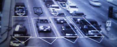
Blocking All Lanes: Sig-Alerts, detection loops, and the management of traffic
Sean Dockray, Steve Rowell, & Fiona Whitton
Cabinet Magazine / Spring 2005
Chris Kahle
Chris researches the Los Angeles urban landscape, parks, and open space. He's worked in GIS before and now is moving into the realm of cultural geography. He has conducted qualitative research in Paris studying citizen participation in urban land transformation efforts to create parks. Now he is developing a dissertation proposal to compare these processes in Paris parks and Los Angeles parks along the LA River. On the side, he is curating a show at LA's Municipal Art Gallery, "Genius Loci," showcasing art works about LA that incorporate cartographic methods/modes/designs as well as historic pictorial maps of the city - the show opened in Feb 2002 at SciArc in downtown LA. He has held an NSF Sustainable Cities Program Fellowship, a USC Tyler Environmental Scholarship, and was a USC Presidential Fellow.
Lize Mogel
Lize Mogel is an interdisciplinary artist who works with the interstices between art and cultural geography, distributing and inserting cartographic projects into public space. Recent work asks viewers to become active producers of their local landscape. She also works with the radio collaborative neuroTransmitter, and is currently an Architecture/Urban Studies Fellow at the Whitney Museum Independent Study Program.
Open House at the Nevada Test Site
Kitt Peak, Arizona
Zelig Kurland / Civil Affairs: Scenes from Oregon's Budget Impasse
The term "public space" brings to mind beloved showcases of civic pride and community life: schools, libraries, parks, plazas, Main Street.
Behind the scenes there is the space of government agencies and publicly-supported services that strive to facilitate life, liberty, and the pursuit of happiness when there are needs that cannot be met by the private sector alone.
Faced with declining tax revenues at the beginning of this decade, the majority of states cut services—especially health care—to reduce their spending. Massacusetts stopped health coverage for 36,000 people. Tennessee ended coverage for 208,000 residents. And so on.
Ewan Branda
I am an architect and software designer currently working on a Ph.D. in the Department of Architecture and Urban Design at UCLA. My work deals with epistemologies of information technolology in architectural history and theory. I'm particularly interested in new modes of urban and landscape representation latent in emerging information technology paradigms such as location aware computing. My current research is on information media and the origins of the archaeological park in the 19th century.
Angela Loughry
Angela Loughry’s academic and professional activities explore of the natural/urban interface in the contemporary city. As a recent transplant to Los Angeles, she finds the city to be an extraordinary laboratory for this exploration. She engages this urban laboratory whenever possible through research, teaching and practice. Her research activities focus on local land uses that reveal the interaction of the natural and the man-made. Independently and partnered with the Center for Land Use Interpretation (CLUI) she researches such phenomena as dams, view sheds, and water systems and their effects on the urban fabric of Los Angeles. At Woodbury, this examination extends into the classroom through contemporary issues seminars that explore the landscape of Los Angeles and design studios driven by a deep interaction with site. She furthers this examination with speculative design projects. Her most recent project, which examined parking surfaces, was a finalist in several design competitions.
William Fox
William L. Fox is a writer, independent scholar, and poet whose work is a sustained inquiry into how human cognition transforms land into landscape. His numerous nonfiction books rely upon fieldwork with artists and scientists in extreme environments to provide the narratives through which he conducts his investigations.
Fox was born in San Diego and attended Claremont McKenna College. He has edited several literary magazines and presses, among them the West Coast Poetry Review, and worked as a consulting editor for university presses, as well as being the former director of the poetry program at the Squaw Valley Community of Writers.
In the visual arts, Fox has exhibited text works in more than two dozen group and solo exhibitions in seven countries, served as the Associate Director of the Nevada Museum of Art, and then as the visual arts and architecture critic for the Reno Gazette-Journal newspaper.
In late 1979 he went to work at the Nevada Arts Council, first as the Coordinator of the Artists-in-Residence Program, then Deputy Director, and in 1984 Executive Director, a post he held until leaving in 1993 to write full time.
Fox has published poems, articles, reviews, and essays in more than seventy magazines, has had fourteen collections of poetry published in three countries, and has written eight nonfiction books about the relationships among art, cognition, and landscape. He has taught rockclimbing at the University of Nevada, as well as led treks in the Himalaya.
In 2001-02 he spent two-and-a-half months in the Antarctic with the National Science Foundation’s Antarctic Visiting Artists and Writers Program. Fox has also worked as a team member of NASA’s Haughton-Mars Project, which tests methods of exploring Mars on Devon Island in [the Canadian High Arctic.] He was a visiting scholar in residence at the Getty Research Institute in Los Angeles, has twice been a Lannan Foundation writer-in-residence, and has been awarded fellowships from the Guggenheim Foundation and the National Endowment for the Humanities.
Playa Works: The Myth of the Empty
In his new collection of essays, William L. Fox combines eloquent storytelling and engaging scholarship to examine why and how humans are compelled to leave their imprints on the most extreme lands—the dry lake beds of the arid earth.
Polar Program: Antarctic 1
The Center’s Polar Program exhibited its first public presentation in September, a project developed with the writer William Fox, who spent the last austral summer on Antarctica conducting research for the National Science Foundation (NSF) and the CLUI. The exhibit, entitled Antarctic 1: Views Along Antarctica’s First Highway, opened in September 2002, featuring images from several photographers, with text captions by William Fox. Focusing on the places along the continents only real road, unofficially named “Antarctic 1,” the program examines the mechanisms and infrastructure of life-support and research that take place throughout this remote and inhospitable “continent of science.”
Deborah Stratman
Deborah Stratman is an award-winning filmmaker and artist based in Chicago. She received her M.F.A. from the California Institute of Arts and her B.F.A. from the School of the Art Institute of Chicago. Since 1990 she has completed more than a dozen film projects, both on sixteen-millimeter film and on video. These works have been shown at international film festivals—including the Sundance Film Festival in Utah, the Rotterdam International Film Festival in the Netherlands, and the Vienna International Film Festival in Austria—and at art institutions such as the Wexner Center for the Arts, Columbus, Ohio, and the San Francisco Art Institute.
Wendover Residence Program - Deborah Stratman
Deborah Stratman was a resident in 2002, and made subsequent visits in 2003, and 2004 to complete her project. While in Wendover, she engaged in a project called Power/Exchange, which involved the erection of a 50 foot tall radio tower of her design, and the distribution of a booklet at vending boxes throughout the region.
Bill Brown / DreamWhipZine
You can take Bill Brown out of Texas, but you can’t take the Texas out of Bill Brown. His films are vast and expansive and take you on a road trip across the back roads of forgotten places. From his award winning Confederation Park, which carefully depicts an aimless American kid setting out across the Trans-Canada Highway, to Buffalo Common, which observes the dismantling of nuclear missile silos across North Dakota, Bill’s films blur the difference between documentary and personal filmmaking and create a time-capsule of the subtle changes of the North American landscape. His films have won many awards and screened at nearly every film festival on the planet, he has received both Rockefeller and Creative Capital grants, and in November 2003, the Museum of Modern Art presented a retrospective of his work. His ‘turn-ons’ include blimps, elevated trains, and vegan bratwurst, but the steady tug of time passing and Hummers leave him less excited.
Wendover Residence Program - Bill Brown
Bill Brown was a resident in 2004. while in Wendover, he constructed the "Railbike," a tandem bicycle with an outrigger, that he used for exploring and documenting the abandoned railroads of the area. The Railbike remains at CLUI Wendover as a resource for current and future residents.
Igor Vamos
Igor Vamos lives in Albany, New York and teaches video and media arts at the Rensselaer Polytechnic Institute in nearby Troy. His work takes the form of strategic interventions in public sites and electronic networks, and experimental films that borrow from the conventions of the documentary. Since the early nineties, his various interventions, created in collaboration with such activist groups as ®TMark or Yes Men, have met with critical acclaim in the electronic and print media. His skill in staging public-art events and attracting media coverage guarantee his projects a vast audience, far exceeding the normal scope of contemporary art. Since Vamos creates the majority of his projects as an anonymous member of activist groups, it is difficult to determine his exact contribution. [MORE]
A Higher Plain: The Rajneesh Ranch Revisited
Have You Ever Navigated the Erie Canal?
Arecibo, Puerto Rico: A Giant Ear Built Onto the Earth
Melinda Stone
A filmmaker, curator, and teacher, Stone has produced over twenty films and videos, as well as numerous outdoor cinematic productions. Stone has a deep affinity for the American West and road travel; the subjectivity of her work often extends from historic research and the mining of cultural conditions found immediately in the land. Stone’s whimsical sensibility and romanticism surface in her ongoing interest in amateur productions and experimental screening practices, which often incorporate live music and participatory sing-alongs. Her site-related outdoor film events are always generous in spirit, evoking an awareness of the landscape and merging real time with the experience of the moving image. These events have taken place in locales such as Hunters Point (Sink or Swim, 2001) and Piru, California (Fleur Power, 1998). Her most ambitious screening event, The California Tour, was presented at drive-in theaters located throughout the state during the spring and summer of 2003. For this roving multivenue presentation, Stone curated footage submitted by amateur filmmakers under the pretense that it was “about California” and projected selections onto large screens of both abandoned and operating drive-ins for locals.
Stone’s commissioned Rambling in Repose, 2005, is a lounging environment, furnished with recliners, walls adorned by film club awards, and shelves lined with trophies. A monitor provides the opportunity for viewers to select DVD-transferred 16 mm films made by San Franciscan amateur filmmakers from a playlist. The films depict past moments of leisure recorded by amateurs in and around San Francisco since the 1950s. The selection includes Tuneful Wings (a fantasy-like, backyard avian adventure shot on Twin Peaks); Moods of a City (a 1970s group production that reflects the city in the 1970s); a film that looks at life at Hunters Point; a short by an Italian filmmaker, Sal Tufo, set in his family’s local restaurant; and a travelogue recorded by Bucky the Antelope while on his jet-setting adventures.
Stone received a BA in speech communication and journalism from Humboldt State University in 1989, a MS in communication from San Diego State University in 1992, and a PhD in communication from the University of California, San Diego, in 2003. Her PhD dissertation focused on American amateur cinema clubs, a pastime that Stone considers demonstrates true love of the media. She is currently assistant professor of media studies at the University of San Francisco. Stone is also one of the founders and current director of film projects for the Center for Land Use Interpretation in Culver City, California.
Suggested Photo Spot Project
Media Artists Melinda Stone and Igor Vamos initiated and executed the Photo Spot Project for The Center, installing over 50 "Suggested Photo Spot" signs at selected sites from coast to coast. Sights designated as a "Suggested Photo Spot" include the tailings pile of a copper mine and the waste water treatment facility for the Kodak company's headquarters. But the spots are not selected simply according to the function of facilities or land uses at the site. The criteria for selecting the Spots primarily relate to tourist photography issues, based on visual and aesthetics considerations, and a sense of what might be "photogenic". "In most cases, you have to be there to fully get it", says Stone, "the pictures we take of the Photo Spots represent just one aspect of the site, but the project is really about the interaction of viewers with each location".
Angola Prison and Prison Museum
Land Arts of the American West
Land Arts of the American West is an interdisciplinary, studio-based, field study program that investigates the overlay of land arts practices from pre-contact times to the contemporary era. The program has been formed around the following goals:
Land Arts investigates the spectrum of site interventions from pre-contact Native American to contemporary Euro-American cultures.
Land Arts provides students with direct physical contact with the sites under study.
Land Arts is a studio-based program that requires students to work in the field in direct response to site-specific conditions and provocations.
Land Arts asserts that an interdisciplinary discourse (art, architecture, and design) is essential to a full apprehension of the meaning of these sites.
Land Arts is dedicated to the idea that cultural expressions are influenced by place.
Land Arts contends that students educated in the universities of the Southwestern United States should be cognizant of the human interventions in this landscape across time and cultures.
Land Arts hinges on bringing Art and Design together in ways that extend beyond the notion of “art in the landscape” or the “documentation of the landscape.” By placing students both in the landscape, and between disciplines, the program provides a space where the boundaries between these disciplines become as tenuous as the boundaries in the landscape itself. Living on the land for weeks at a time, moving through the landscape in seamless experience and working directly in the environment students develop skills of perception and analysis unattainable in a classroom setting.
Assembling a diverse group of students and faculty from different institutions and disciplinary backgrounds is critical to the foundation of Land Arts. Bringing individuals from different geographic and cultural backgrounds together provides a space of inquiry for questions of the individual and the environment. Bill Gilbert, Professor of Art, at the University of New Mexico, and Chris Taylor, Assistant Professor of Design, at the University of Texas at Austin jointly direct the program. Course offerings and curricular structure are integrated jointly into the respective programs (disciplines) and capitalize on the strengths of an interdisciplinary inquiry.
Polar Inertia Journal
Armed with a laptop computer and increasingly aging Winnebago, our editor-in-chief Marcel E. Yarnow has brought together artists and writers who can tell the story which has been ignored by all others. It is the story of the highway, mobile home, fast food chain, suburbanite, truck stop and industrialized landscape, which characterize our growing nomadic culture. Polar Inertia is interested in your feedback, and contributions are encouraged, we accept short stories, photography, and essays dealing with personal experiences from all edges of nomadic and popular culture.
Polar Inertia journal is an outlet and a resource for on going research into the networks that define the contemporary city. The journal began with the idea that an understanding of the conditions of post war urbanism requires immersion into the technologies and instruments that have molded the growth and image of the city. Using Los Angeles as a primary research laboratory, Polar inertia works under the belief that by exploring and documenting the infrastructure and land use patterns we can begin to understand the contemporary and future city. The research in the journal provides a basis from which to explore the potential for alternative proposals for urban development informed from the daily realities of the city.
Museum of Jurassic Technology
The Museum of Jurassic Technology in Los Angeles, California is an educational institution dedicated to the advancement of knowledge and the public appreciation of the Lower Jurassic.
MOISTURE / Claude Willey & Deena Capparelli
MOISTURE is an experimental research project undertaken by a Los Angeles-based artist collective. Focused on developing location-sensitive structures for the collection, retention, and use/re-use of water in the Mojave Desert, the collective are invested in creating microclimates within one of the driest desert regions on the planet.
Since the winter of 2002, the evolving project has developed into an annual research program centered on Harper Dry Lake, near Hinkley, California. The current phase of the program involves the design and construction of functional sculptural objects, installed in relation to the ground, and the hydrologic matrix of the region. All individual components and larger collaborative projects are to be seen as puzzle-pieces aiding in the long-range understanding of this unique closed-basin.
The Harper Basin is a distinct drainage basin within the Mojave Desert, and as an exhausted agricultural area, with a large dry lake at its bottom, its history and present condition is emblematic of modern human development in desert regions. The MOISTURE collective intend to establish a prolonged presence in this Harper Basin, working both with and against the region’s changing water cycles.
Invisible Trajectories: Accidental Attributes of Two Moving Bodies: Unique Circumstances and Reconstructed Journeys in the California Inland Empire
etc. etc. etc. etc.
The Center for Land Use Interpretation is maintained by a dedicated staff and volunteer base including (but not limited to):
A-Z: Lisa Boulanger, Ewan Branda, Molly Brubaker, Matthew Coolidge, Mark Curtin, Sean Dockray, John Fitchen, Heather Frazar, Jennifer Gabrys, Chris Kahle, Michael Kassner, Erik Knutzen, Mathias Kolehmainen, Zelig Kurland, Carrie Lincourt, Ben Loescher, Angela Loughry, Suzanna Mast, Ryan McKinley, Lize Mogel, Richard Pell, John Reed, Steve Rowell, Sarah Simons, Melinda Stone, Dave Vamos, Igor Vamos, Kazys Varnelis, Fiona Whitton.
Sunday, June 04, 2006
Art & Mapping
The Moveable Feast
A map of weekly gatherings that travel from restaurant to restaurant throughout the Twin Cities, so people can meet to eat, talk and build community.
Kali Nikitas, Richard Shelton
The North American Cartographic Information Society (NACIS) has released a special issue of their journal, Cartographic Perspectives:
Art and Mapping
Issue 53, Winter 2006
Edited by Denis Wood and John Krygier
Price: $25
The issue includes articles by kanarinka, Denis Wood, Dalia Varanka and John Krygier, and an extensive catalogue of map artists compiled by Denis Wood. See abstracts below.
Twin Cities Odorama: A Smell Map of Minneodorous and Scent Paul
Olfactory experiences emanating from the intersections of people, enterprise and physical environments.
Becky Yust, Lindsay Shen, James Boyd-Brent, Carol Waldron
Map Art
Denis Wood
Artists make maps. Inspired by maps made by the Surrealists, by the Situationists, by Pop Artists, and especially by Conceptualists of every stripe, artists in increasing numbers have taken up the map as an expressive medium. In an age less and less enamored of traditional forms of representation – and increasingly critical – maps have numerous attractions for artists. Beyond their formal continuities, maps and paintings are both communicative, that is, constructs intended to affect behavior. As the energy of painting has been dispersed over the past half century into earth art, conceptual art, installation art, performance art, video art, cyber art, and so on, it has dispersed the map as a subject along with it. The irresistible tug maps exert on artists arises from the map’s mask of neutral objectivity, from its mask of unauthored dispassion. Artists either strip this mask off the map, or fail to put one on. In either case artists simultaneously point to the mask worn by the map, while they enter unmasked into the very discourse of the map. In so doing map artists are erasing the line cartographers have tried to draw between their form of graphic communication (maps) and others (drawings, paintings, and so on). In this way map artists are reclaiming the map as a discourse function for people in general. The flourishing of map art signals the imminent demise of the map as a privileged form of communication. The map is dead! Long live the map!
MSP Grain: An Urban-Agrarian-Urban Digest
The economic-geography of grain — production, transportation, storage, transactions and foodstuffs, from grain elevators and flour mills to fortune-cookie factories.
Robert Adams, Dawn Gilpin, Chad Kloepfer
Interpreting Map Art with a Perspective Learned from J.M. Blaut
Dalia Varanka
Map art has been mentioned only briefly in geographic or cartographic literature, and has been analyzed almost entirely at the interpretive level. This paper attempts to define and evaluate the cartographic value of contemporary map-like art by placing the body of work as a whole in the theoretical concepts proposed by J.M. Blaut and his colleagues about mapping as a cognitive and cultural universal. This paper discusses how map art resembles mapping characteristics similar to those observed empirically in very young children as described in the publications of Blaut and others. The theory proposes that these early mapping skills are later structured and refined by their social context and practice. Diverse cultural contexts account for the varieties, types, and degrees of mapping behavior documented with time and geographic place. The dynamics of early mapping are compared to mapping techniques employed by artists. The discipline of fine art serves as the context surrounding map artists and their work. My visual analysis, research about the art and the artists, and interviews with artists and curators form the basis of my interpretation of these works within varied and multiple contexts of late 20th century map art.
Growing Together: the Twin Cities Community in Gardens
The culture and agriculture of diverse neighborhoods and their community gardens as places for meeting and building community.
Wendy Fernstrum, Chris Faust, Mike Tincher
Art-Machines, Body-Ovens and Map-Recipes: Entries for a Psychogeographic Dictionary
kanarinka
A map is more than a picture, but what are artists doing about it? “Mapping” has exploded as an artistic practice. Artists are making geographic maps, psychogeographic maps, sound maps, demographic maps, data-driven maps, and emotional maps. Artists are performing maps—enacting and documenting location like never before. With the advent of new media art, GIS and mobile technologies, the concern with data collection and mapping through locative media is pursued with both romance and criticality. This article presents a dictionary of terms and projects that demonstrate the variety and complexity of these map-art practices. These projects utilize the map in a political and social dimension to produce new configurations of space, subjectivity and power. Their methodology is based on an ethics of experimentation; the map is a tool to experiment with a particular territory in specific ways in order to reach unforeseen destinations.
Artists and projects discussed include: Alex Villar, Brian DeRosia, Bureau D’Etudes, Cheryl l’Hirondelle, Glowlab, iKatun, Institute for Applied Autonomy, Institute for Infinitely Small Things, John Osorio-Buck & Matthew Ward, Lee Walton, María Bogadóttir and Malene Rordam, Mobilivre-Bookmobile, Natalie Loveless, Nomads+Residents, Shih-Chieh Huang, Sifting the Inner Belt & spurse.
Ethni-Cities: A Cultural Calendar of Immigrant Community Festivals
A Knowledge Map and accompanying website of ethnic community festivals, revealing the enrichment of Twin Cities culture by immigrants from Mexico, Iran, Laos and Ethiopia.
Malini Srivastava, Zoe Adler-Resnik, Meena Natarajan, Pramila Vasudevan
Jake Barton’s Performance Maps: An Essay (PDF)
John Krygier
Jake Barton, a New York-based designer, creates public maps that generate social interaction, personal expression, and collaborative storytelling. Barton’s work is centered on performance, drawing attention to the performative capacity of maps, a seldom-explored facet of cartographic design and theory. Examples of Barton’s projects, realized and unrealized, are detailed, with a focus on the manner in which maps are designed to evoke performance.
50 Sound Stories + 466 Decibel Readings: A Sound Map and Audio CD
An audio map of the Twin Cities that charts citywide decibel levels and collects residents' sonic stories of the city.
Rachel Hutton, Rachel Thompson, Jonathon Zorn, Alissa Clark, Rob Giampietro
Catalogue of Map Artists
Compiled by Denis Wood
This catalogue is largely based on the contents of ten map art exhibitions, as well as on a handful of books that deal with a significant number of map art pieces. Though it is without question the most extensive catalogue of map artists so far published, it makes no pretense of being complete. Its role is to document the fact that a lot of artists work with maps, and to provide a foundation for the work that remains to be done. The artists have been arranged alphabetically. Where we have been able to determine these, we have provided, in parentheses, where the artist lives/works now or predominantly (in any event, not the place of birth or nationality), followed by the date of birth (and where appropriate, death). There is a brief description of artist’s work, followed by a key to the sources. These are listed at the end of the catalogue. Only the lightest culling has been attempted, but artists working today with but a single known piece of map art in their oeuvre have been less likely to be included than those with many or than those artists of the relative past whose work may have influenced the work of those active today.
Write Your Own City: A Palimpsest of Personal Geographies
A map that charts personal journeys and favorite spaces as recorded by users of PDPal, a new piece of custom map-making software for handheld organizers, commissioned separately by the Walker Art Center.
Scott Paterson, Marina Zurkow, Julian Bleeker
TO ORDER
Send a check for $25 (US) for the special issue of Cartographic
Perspectives on Art & Mapping (Number 53, Winter 2006) to NACIS.
Payment includes 1st class postage.
Mail check to:
NACIS
PO Box 399
Milwaukee, WI 53201-0399 USA
Include "for Art & Mapping, CP 53, Winter 2006" on check. Also
include your name, mailing address, and email address. Outside of US:
you may use a credit card. Please contact Susan Peschel: sqp@uwm.edu.
Divining the Twin Cities: Physical Journeys, Spiritual Places
A map of places and sites for personal renewal, spiritual transformation and respite from the world of consumption.
James Boyd-Brent, Thomas Fisher, Kristofer Layon, Virajita Singh
Experiments with Territories: Post Cartographic Map Design
Sessions organized for the Association of American Geographers (AAG) Annual Meeting, March 7-11 2006, Chicago Illinois
IMAGES > University of Minnesota > Design Institute > Twin Cities Knowledge Maps
Subscribe to:
Posts (Atom)